


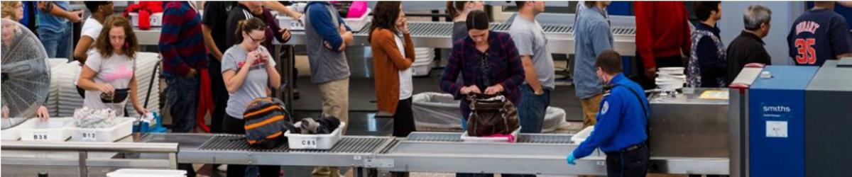
The following items that are banned for carriage on person/hand baggage on board flights operating from civil airports in India; and Indian Registered aircrafts from foreign airports : Personal Items
 Sharp Objects
 Sporting Goods
 Guns and Firearms
 Tools
Tools
 Martial Arts / Self Defense Items
 Explosive Materials
 Flammable items
 Disabling Chemicals and other Dangerous Items
Note : The above mentioned are only indicative lists of items. Commonsense, however, shall prevail in assessing whether an object can be used as a weapon for committing any act of unlawful interference with civil aviation operations.
Security related information
Lost and found Baggage

| VAUD AD 2.1 AERODROME LOCATION INDICATOR AND NAME |
| VAUD - UDAIPUR/ DOMESTIC |
VAUD |
AD 2.2 |
AERODROME GEOGRAPHICAL AND ADMINISTRATIVE DATA |
| 1 | ARP coordinates and site at AD | 243703N 0735340E 76.5°/300M from intersection of RWY and TWY. |
| 2 | Direction and Distance from City | 077°/18KM from Udaipur. |
| 3 | Elevation/Reference temperature | 1684 FT / 39.0°C |
| 4 | MAG VAR/Annual change | 3.00°W (1985) /0.017W |
| 5 | AD Administration, address, telephone, telefax, telex, AFS | Airport Director, Airports Authority of India, Maharana Pratap Airport, Udaipur -313023. Tel +91-294-2655950,2655279, 2657735-38 Tel +91-9414159950 Fax: +91-294-2655953,2655460, 2655279 AFS: VAUDYHYX |
| 6 | Types of traffic permitted | IFR/VFR |
| 7 | Remarks | Nil |
VAUD |
AD 2.3 |
OPERATIONAL HOURS |
| 1 | AD Administration | MON-FRI : 0400-1200 (0930-1730 IST) SAT,SUN+ HOL :Nil |
| 2 | Customs and immigration | Nil |
| 3 | Health and sanitation | May be arranged on request basis. |
| 4 | AIS briefing office | As ATS |
| 5 | ATS reporting office (ARO) | As ATS |
| 6 | MET briefing office | As ATS |
| 7 | ATS | Consult NOTAM for current ATS HR. |
| 8 | Fueling | As ATS |
| 9 | Handling | As ATS |
| 10 | Security | H24 |
| 11 | De-icing | Nil |
| 12 | Remarks | Outside of ATS HRS services are available O/R with 24 HR PN to Airport Director. |
VAUD |
AD 2.4 |
HANDLING SERVICES AND FACILITIES |
| 1 | Cargo-handling facilities | Nil |
| 2 | Fuel/Oil types | JET A1 (ATF) |
| 3 | Fuelling facilities/capacity | IOCL : 2 Bowsers 9,000 Liters each, 20Litres/SEC Reliance : i) 2 Bowsers of 6000 litres each ii) 2 Bowsers of 11000 litres each iii) 1Bowsers of 16000 litres each |
| 4 | De-icing facilities | Nil |
| 5 | Hangar space for visiting aircraft | Nil |
| 6 | Repair facilities for visiting aircraft | Nil |
| 7 | Remarks | Nil |
VAUD |
AD 2.5 |
PASSENGER FACILITIES |
| 1 | Hotels | In the city. |
| 2 | Restaurants | At AD and in the city |
| 3 | Transportation | Taxis and car hire from the AD. |
| 4 | Medical facilities | First aid at AD, Hospital in the city. |
| 5 | Bank and Post Office | Banks: Bank of India ATM open round the clock. Post office: Nil |
| 6 | Tourist office | At AD |
| 7 | Remarks | Nil |
VAUD |
AD 2.6 |
RESCUE AND FIRE FIGHTING SERVICES |
| 1 | AD category for fire fighting | Within ATS HR: CAT 6 |
| 2 | Rescue equipment | AVBL. as per category. |
| 3 | Capability for removal of disabled aircraft | Nil |
| 4 | Remarks | Nil |
VAUD |
AD 2.7 |
SEASONAL AVAILABILITY- CLEARING |
| 1 | Types of Clearing Equipment | Nil |
| 2 | Clearance priorities | Nil |
| 3 | Remarks | Nil |
VAUD |
AD 2.8 |
APRONS, TAXIWAYS AND CHECK LOCATIONS DATA |
| 1. | Apron surface and strength | Surface | Concrete & Tarmac |
| Strength | 64/R/C/W/T | ||
| 2. | Taxiway width, surface and strength | Width | 23M (Shoulder 7.5M ) |
| Surface | Tarmac | ||
| Strength | 64/R/C/W/T | ||
| 3. | ACL and elevation | Location | At apron |
| Elevation | 509.7M(1672FT) | ||
| 4. | VOR/INS checkpoints | VOR | On TWY |
| INS | Nil | ||
| 5. | Remarks: 1) APRON: Apron size -165x91M with 7.5M shoulder on North, West South sides. Location: 85M North of RWY 08/26 at a distance of 524.35M from beginning of RWY08. Elevation of the highest point of Apron: 510.315M AMSL Aircraft stands: 03 NOS stand NO. 03,04 and 05. 2) TWY ‘A’(length : 85m) located North of RWY 08/26, at a distance of 524.35M from the beginning of RWY08 . 3) TWY’ D(length :193M ) located north of RWY 08/26, at a distance of 2301M from the beginning of RWY08. 4) ISOLATION BAY: Size 91MX76M with 7.5 shoulders on each side. Location: 193M north of RWY 08/26 at a distance of 2301M from beginning Of RWY 08. PCN : 64/R/C/W/T Elevation of the highest point of the isolation bay: 507.25M | ||
VAUD |
AD 2.9 |
SURFACE MOVEMENT GUIDANCE AND CONTROL SYSTEM AND MARKINGS |
| 1 | Use of aircraft stand ID signs, TWY guide lines and visual docking/parking guidance system of aircraft stands | Taxiing guidance provided on R/T, Guidelines at Apron |
| 2 | RWY and TWY markings and LGT | RWY: Marked : Designation, THR, TDZ, Centreline, Aiming point, edge Lighted :THR, edge and end . TWY: Marked : Centreline, Holding Position, Edge . Lighted : Edge. |
| 3 | Stop bars | Nil |
| 4 | Remarks | Medium intensity Apron edge lights |
VAUD |
AD 2.10 |
AERODROME OBSTACLES |
| In approach / TKOF areas | |||||
| 1 | 2 | 3 | 4 | 5 | 6 |
| RWY NR/Area affected | Obstacle type | Coordinates | Elevation | Marking/LGT | Remarks |
| APCH-08 TKOF-26 affected | MOBILE RD. TFC | 243657.9 N 0735301.5 E | 1707 FT | NIL | NIL |
| APCH-08 TKOF-26 affected | SPOT LEVEL | 243657.0 N 0735304.9 E | 1691 FT | NIL | NIL |
| APCH-08 TKOF-26 affected | FENCING TOP | 243655.2 N 0735301.9 E | 1697 FT | NIL | NIL |
| APCH-08 TKOF-26 affected | FENCING TOP | 243654.1 N 0735305.2 E | 1704 FT | NIL | NIL |
| APCH-08 TKOF-26 affected | SPOT LEVEL | 243654.7 N 0735256.3 E | 1703 FT | NIL | NIL |
| APCH-08 TKOF-26 affected | SPOT LEVEL | 243658.8 N 0735254.2 E | 1702 FT | NIL | NIL |
| APCH-08 TKOF-26 affected | LLZ HUT | 243659.0 N 0735252.9 E | 1715 FT | NIL | NIL |
| APCH-08 TKOF-26 affected | FENCING TOP | 243659.3 N 0735252.2 E | 1712 FT | NIL | NIL |
| APCH-08 TKOF-26 affected | TREE | 243656.5 N 0735249.4 E | 1759 FT | NIL | NIL |
| APCH-08 TKOF-26 affected | TREE | 243657.4 N 0735248.6 E | 1744 FT | NIL | NIL |
| APCH-08 TKOF-26 affected | KUTCHA WAY | 243653.9 N 0735258.2 E | 1713 FT | NIL | NIL |
| APCH-08 TKOF-26 affected | TREE | 243655.3 N 0735233.0 E | 1761 FT | NIL | NIL |
| APCH-08 TKOF-26 affected | TREE | 243651.2 N 0735234.4 E | 1743 FT | NIL | NIL |
| APCH-26 TKOF-08 affected | TREE | 243706.2 N 0735432.1 E | 1724 FT | NIL | NIL |
| APCH-26 TKOF-08 affected | TREE | 243712.6 N 0735436.6 E | 1699 FT | NIL | NIL |
| APCH-26 TKOF-08 affected | TREE | 243713.9 N 0735441.9 E | 1704 FT | NIL | NIL |
| APCH-26 TKOF-08 affected | TREE | 243707.7 N 0735439.0 E | 1696 FT | NIL | NIL |
| APCH-26 TKOF-08 affected | TREE | 243708.0 N 0735433.8 E | 1689 FT | NIL | NIL |
| APCH-26 TKOF-08 affected | TREE | 243710.2 N 0735444.2 E | 1706 FT | NIL | NIL |
| APCH-26 TKOF-08 affected | TREE | 243715.7 N 0735448.4 E | 1709 FT | NIL | NIL |
| APCH-26 TKOF-08 affected | TREE | 243707.1 N 0735451.8 E | 1730 FT | NIL | NIL |
| APCH-26 TKOF-08 affected | TREE | 243711.9 N 0735452.8 E | 1724 FT | NIL | NIL |
| APCH-26 TKOF-08 affected | TREE | 243713.9 N 0735457.2 E | 1718 FT | NIL | NIL |
VAUD |
AD 2.11 |
METEOROLOGICAL INFORMATION PROVIDED |
| 1 | Associated MET Office | Udaipur |
| 2 | Hours of service MET Office outside hours | As ATS HR --- |
| 3 | Office responsible for TAF preparation period of validity | Jaipur/Delhi 9 HR |
| 4 | Trend forecast interval of issuance | Nil |
| 5 | Briefing/consultation provided | Nil |
| 6 | Flight documentation Language(s) used | Tabular Form English |
| 7 | Charts and other information available for briefing and consultation | Nil |
| 8 | Supplementary equipment available for providing information | Nil |
| 9 | ATS units provided with information | Udaipur ATC and ACS |
| 10 | Additional information (limitation of service, etc.) | Documentation provided O/R. |
VAUD |
AD 2.12 |
PHYSICAL CHARACTERISTICS |
| Designations RWY NR | TRUE & MAG BRG | Dimensions of RWY (M) | Strength (PCN) and surface of RWY and SWY | THR coordinates | THR elevation and highest elevation of TDZ of precision APP RWY (FT) |
| 1 | 2 | 3 | 4 | 5 | 6 |
| 08 | 81.52° GEO 81.75° MAG | 2281 x 45 | 64/F/C/X/T Tarmac Concrete | 243658.90N 0735311.20E | THR:1680.0FT |
| 26 | 261.50° GEO 261.68° MAG | 2281 x 45 | 64/F/C/X/T Tarmac Concrete | 243708.40N 0735426.40E | THR:1663.0FT |
| Slope of RWY-SWY | SWY dimensions (M) | CWY dimensions (M) | Strip dimensions (M) | OFZ | Remarks |
| 7 | 8 | 9 | 10 | 11 | 12 |
| -.24% | --- | --- | 2401 x 150 | --- | --- |
| +.24% | --- | --- | 2401 x 150 | --- | --- |
VAUD |
AD 2.13 |
DECLARED DISTANCES |
| RWY designator | TORA (M) | TODA (M) | ASDA (M) | LDA (M) | Remarks |
| 1 | 2 | 3 | 4 | 5 | 6 |
| 08 | 2281 | 2281 | 2281 | 2131 | --- |
| 26 | 2281 | 2281 | 2281 | 2281 | --- |
VAUD |
AD 2.14 |
APPROACH AND RUNWAY LIGHTING |
| Designations RWY | APCH LGT TYPE LEN INTST | THR LGT COLOUR WBAR | VASIS (MEHT) PAPI | TDZ, LGT LEN | RWY centre line LGT Length, spacing, colour and intensity | RWY edge LGT Length, spacing, colour and intensity |
| 1 | 2 | 3 | 4 | 5 | 6 | 7 |
| 08 | SALS 420M Variable | Green | PAPI Left/3° | -- | -- | 2281M 60M White , LIH |
| 26 | SALS 420M | Green | PAPI Left/3° | -- | -- | 2281M 60M White , LIH |
| RWY end LGT colour WBAR | SWY LGT LEN (M) colors | Remarks |
| 8 | 9 | 10 |
| Red | -- | SALS avbl at spacing 30M upto 420M with crossbar at 300M from THR. |
| Red | -- | --- |
VAUD |
AD 2.15 |
OTHER LIGHTING, SECONDARY POWER SUPPLY |
| 1 | ABN/IBN Location, characteristics and hours of operation | ABN : At Tower Building, FLG W&G EV2SEC. As ATS HR IBN : Nil |
| 2 | LDI location and LGT Anemometer location and LGT | LDI: North of RWY Anemometer: East of APRON. |
| 3 | TWY edge and centre line lighting | Center line: Nil Edge: All TWY |
| 4 | Secondary power supply/switch-over time | Secondary Power supply to all lighting at AD. Switch-over time: 7 SEC. |
| 5 | Remarks | Nil |
VAUD |
AD 2.16 |
HELICOPTER LANDING AREA |
| Not Established |
| VAUD | AD 2.17 | ATS AIRSPACE |
| 1 | Designation and lateral limits | Udaipur CTR A Circle radius 55.5 KM (30NM) centred at 243646N 0735339 E (VOR) 'UUD' |
| 2 | Vertical limits | SFC to FL150 |
| 3 | Airspace classification | D |
| 4 | ATS unit call sign Language(s) | Udaipur Tower English |
| 5 | Transition altitude | 6000FT MSL |
| 5 | Transition altitude | 6000FT MSL |
VAUD |
AD 2.18 |
ATS COMMUNICATION FACILITIES |
| Service designation | Call sign | Frequency | Hours of operation | Remarks |
| 1 | 2 | 3 | 4 | 5 |
| TWR | Udaipur Tower | 122.3 MHZ | As ATS | Nil |
| ATIS | --- | 128.85 MHZ | As ATS |
VAUD |
AD 2.19 |
RADIO NAVIGATION AND LANDING AIDS |
| Type of aid CAT of ILS/MLS (For VOR/ILS/MLS, give VAR) | ID | Frequency | Hours of operation | Site of transmitting antenna | ELEV of DME transmitting antenna | Remarks |
| 1 | 2 | 3 | 4 | 5 | 6 | 7 |
| NDB | LU | 384.0 kHz | As ATS | 243717.4 N 0735644.2 E | --- | --- |
| LLZ 26 | IUDR | 109.9 MHz | As ATS | 243656.0 N 0735301.0 E | --- | --- |
| GP 26 | - | 333.8 MHz | As ATS | 243710.0 N 0735419.0 E | --- | 3°, CH36X RDH/50FT |
| DME | UUD | 1130/1193 MHz | H24 | 243646.4N 0735338.7E | 1719FT | Collocated with VOR |
| DVOR | UUD | 115.9 MHz | H24 | 243646.4N 0735338.7E | --- | |
| DME ( ILS) | IUDR | 997/1060 MHz | As ATS | 243710N 0735419E | 1710FT | Collocated with GP26 CH36X |
VAUD |
AD 2.20 |
LOCAL TRAFFIC REGULATIONS |
| ----------------------- |
| VAUD | AD 2.21 | NOISE ABATEMENT PROCEDURES |
| ----------------------- |
| VAUD | AD 2.22 | FLIGHT PROCEDURES |
| ----------------------- |
| VAUD | AD 2.23 | ADDITIONAL INFORMATION |
| 1. All 180 degree turn on RWY should be made only on turn pads. 2. NON SKED operator to take positive CLR FM VAUD ATC at least 24 HRS in Advance due shortage of parking Bays. |
VAUD |
AD 2.24 |
CHARTS RELATED TO AN AERODROME |
| 1. | ILS RWY 26 procedure chart split into ILS (Z)RWY 26 and ILS (Y)RWY 26 | |
| 2. | VOR (X) RWY 26 procedure chart renamed VOR (Z) RWY 26 | |
| 3. | VOR (Y) RWY 26 | |
| 4. | NDB RWY 26 | |
| 5. | Obstacle Chart Type-A RWY 08 | |
| 6. | Obstacle Chart Type-A RWY 26 |

Airports Authority of India,
Rajiv Gandhi Bhawan,
Safdarjung Airport,
New Delhi-110003
Ph : 91-11-24632950


