

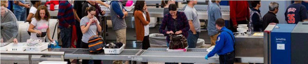
The following items that are banned for carriage on person/hand baggage on board flights operating from civil airports in India; and Indian Registered aircrafts from foreign airports :
 Personal Items
 Sharp Objects
 Sporting Goods
 Guns and Firearms
 Tools
Tools
 Martial Arts / Self Defense Items
 Explosive Materials
 Flammable items
 Disabling Chemicals and other Dangerous Items
Note : The above mentioned are only indicative lists of items. Commonsense, however, shall prevail in assessing whether an object can be used as a weapon for committing any act of unlawful interference with civil aviation operations.
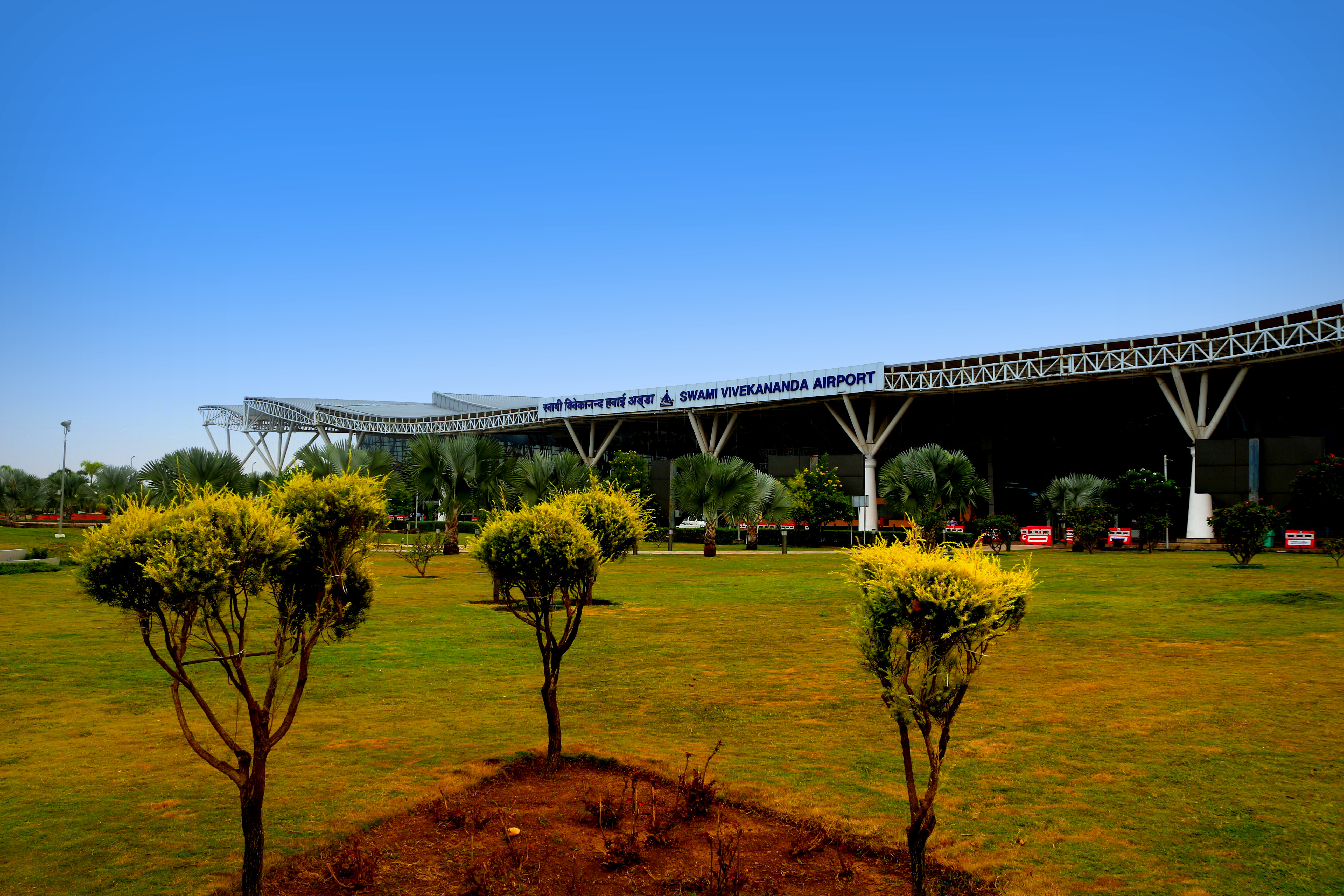
Security related information
Lost and found Baggage

| VARP AD 2.1 AERODROME LOCATION INDICATOR AND NAME |
| VARP - RAIPUR/ DOMESTIC |
VARP |
AD 2.2 |
AERODROME GEOGRAPHICAL AND ADMINISTRATIVE DATA |
| 1 | ARP coordinates and site at AD | 211052N 0814419E 254º/270M from the Intersection of RWY & TWY. |
| 2 | Direction and Distance from City | 135°/18KM from Raipur railway station |
| 3 | Elevation/Reference temperature | 1041 FT / 42.0°C |
| 4 | MAG VAR/Annual change | 1.00°W (1985) /0.017W |
| 5 | AD Administration, address, telephone, telefax, telex, AFS | Airports Authority Of India, Raipur Airport, Raipur -492015 Tel +91-771-2418167 Fax: +91-771-2418168 AFS: VARPYDYX, VARPYHYX TELEX: NIL |
| 6 | Types of traffic permitted | IFR/VFR |
| 7 | Remarks | Nil |
VARP |
AD 2.3 |
OPERATIONAL HOURS |
| 1 | AD Administration | MON-FRI :0400-1200 UTC (0930-1730 IST) SAT, SUN+HOL: NIL |
| 2 | Customs and immigration | Nil |
| 3 | Health and sanitation | Nil |
| 4 | AIS briefing office | AS ATS |
| 5 | ATS reporting office (ARO) | AS ATS |
| 6 | MET briefing office | As ATS |
| 7 | ATS | Consult NOTAM for Current ATS HR. |
| 8 | Fueling | As ATS |
| 9 | Handling | As ATS |
| 10 | Security | As ATS |
| 11 | De-icing | Nil |
| 12 | Remarks | Outside of ATS hour’s services are available O/R with 24 HR PN to AD. |
VARP |
AD 2.4 |
HANDLING SERVICES AND FACILITIES |
| 1 | Cargo-handling facilities | Nil |
| 2 | Fuel/Oil types | ATF, JET A1 |
| 3 | Fuelling facilities/capacity | BPCL : 2x15 KLO,2x12 KL,1x9KL 800/600 liters/min (Total 5 Refuellers) Reliance: 2x11 KL,1x6 KL 700/350 liters/min (Total 3 refuellers) |
| 4 | De-icing facilities | Nil |
| 5 | Hangar space for visiting aircraft | Nil |
| 6 | Repair facilities for visiting aircraft | Nil |
| 7 | Remarks | Nil |
VARP |
AD 2.5 |
PASSENGER FACILITIES |
| 1 | Hotels | In the city |
| 2 | Restaurants | At AD and in the city |
| 3 | Transportation | Taxi and Car hire from the AD. |
| 4 | Medical facilities | First aid at AD. Hospitals in the city. |
| 5 | Bank and Post Office | Banks: In the city. Post office: In the city. |
| 6 | Tourist office | At AD & the city. |
| 7 | Remarks | Nil |
VARP |
AD 2.6 |
RESCUE AND FIRE FIGHTING SERVICES |
| 1 | AD category for fire fighting | CAT -6 |
| 2 | Rescue equipment | AVBL. as per category. |
| 3 | Capability for removal of disabled aircraft | Nil |
| 4 | Remarks | Nil |
VARP |
AD 2.7 |
SEASONAL AVAILABILITY- CLEARING |
| 1 | Types of Clearing Equipment | Nil |
| 2 | Clearance priorities | Nil |
| 3 | Remarks | Airport operational during all seasons. |
VARP |
AD 2.8 |
APRONS, TAXIWAYS AND CHECK LOCATIONS DATA |
| 1. | Apron surface and strength | Surface | Bitumen /Concrete(Old),Concrete (New) | |||
| Strength | PCN 50/F/B/W/T(Old) PCN 54/R/C/X/T (New) | |||||
| 2. | Taxiway width, surface and strength | TWY A | TWY B | TWY C | TWY D | |
| Width | 23M | 23M | 23M | 23M | ||
| Surface | Concrete | Concrete | Bitumen | Concrete | ||
| Strength | 54/R/C/X/T | 54/R/C/X/T | 50/F/B/W/T | 40/R/A/W/T | ||
| 3. | ACL and elevation | Location | At apron | |||
| Elevation | 1033 FT | |||||
| 4. | VOR/INS checkpoints | VOR | --- | |||
| INS | Nil | |||||
| 5. | Remarks: - 1) New Apron:-LOC -North side of RWY 24 adjacent of TMNL BLDG. Dimentions-160/120M,Shoulder-3.5M,Elevation316.336M 2) Parking stands Avbl. with following characteristics:- Stand No. Length Coordinates Type Remark 3 45M 211110N0814443E Power in/Power out Suitable for Acft uptoA321-200 4 45M 211111N0814445E Power in/Power out Suitable for Acft uptoA321-200 5 45M 211112N0814448E Power in/Power out Suitable for Acft uptoA321-200 i. Taxi instruction: ACFT to taxi out turn right and follow lead out line to join TWY ‘A’or TWY ‘B’. ii. Pilots to taxi in and taxi out from apron under own responsibility and under marshler guidance. New apron area partially not visible from ATC TWR. 3). TWY D:Linking RWY 24/06 to isolation bay ,LOC: 1032.6m from beginning of RWY 24 south side, SHOULDER: 7.5m,LENGTH:151.5m. 4) ISOLATION BAY: LOC-South RWY 06/24 connected to TWY "D", Dimensions : 76M X 76M , Shoulder : 7.5M , Surface:Concrete, Strenght : 40/R/A/W/T, Elevation : 1020FT ,Coordinates : 211047N 0814430E8, Critical acft : A320 (pwr in pwr out), Markings : Edge and Centre line markings , Lightings : Blue edge lgt 5). TWY A linking RWY 24/06 to new apron:LOC - 372.25M from beginning of RWY 24 north side, SHOULDER- 3.5M, LENGTH-244M, 6). TWY B linking RWY 24/06 to new aprn :LOC - 509.25M FROM BEGINNING OF RWY 24 NORTH SIDE,SHOULDER-3.5M,LENGTH-244M, 7) TWY C- linking RWY 24/06 to Old Apron. 8) At OLD Apron: Standard Parking position for 2 B737 Non Standard parking for B737 & A320 simultaneously,Positive clearance required for non Sked acft. | |||||
VARP |
AD 2.9 |
SURFACE MOVEMENT GUIDANCE AND CONTROL SYSTEM AND MARKINGS |
| 1 | Use of aircraft stand ID signs, TWY guide lines and visual docking/parking guidance system of aircraft stands | TWY guidance signal at all the intersection with Twy and Rwy and at all holding position Guidelines at Apron.Nose in guidance at aircraft stands. |
| 2 | RWY and TWY markings and LGT | RWY: Marked:Designation,THR,Centerline,Rwy Edge, End Lighted : THR,Rwy Edge, End TWY: Marked: Centerline, Holding Positions at all TWY/RWY intersections Lighted : Twy Edge |
| 3 | Stop bars | Nil |
| 4 | Remarks | Apron Edge and aircraft stand marking avbl. Isolation Bay Marking and Lighting avbl. |
VARP |
AD 2.10 |
AERODROME OBSTACLES |
| In approach / TKOF areas | |||||
| 1 | 2 | 3 | 4 | 5 | 6 |
| RWY NR/Area affected | Obstacle type | Coordinates | Elevation | Marking/LGT | Remarks |
| APCH-06 TKOF-24 affected | GP OF TREES | 211030.7 N 0814338.3 E | 1050 FT | NIL | NIL |
| APCH-06 TKOF-24 affected | GP OF TREES | 211109.9 N 0814456.2 E | 1055 FT | NIL | NIL |
| APCH-06 TKOF-24 affected | GP OF TREES | 211028.8 N 0814335.1 E | 1058 FT | NIL | NIL |
| APCH-06 TKOF-24 affected | TREE | 211019.6 N 0814334.2 E | 1074 FT | NIL | NIL |
| APCH-06 TKOF-24 affected | LLZ HUT | 211029.8 N 0814348.7 E | 1025 FT | NIL | NIL |
VARP |
AD 2.11 |
METEOROLOGICAL INFORMATION PROVIDED |
| 1 | Associated MET Office | Raipur |
| 2 | Hours of service MET Office outside hours | As ATS |
| 3 | Office responsible for TAF preparation period of validity | Raipur 9 Hrs |
| 4 | Trend forecast interval of issuance | Avbl 2 Hrs |
| 5 | Briefing/consultation provided | Avbl |
| 6 | Flight documentation Language(s) used | Tabular form English |
| 7 | Charts and other information available for briefing and consultation | Nil |
| 8 | Supplementary equipment available for providing information | Nil |
| 9 | ATS units provided with information | Raipur ATC and ACS |
| 10 | Additional information (limitation of service, etc.) | Documents Provide A/R (As and when required.) |
VARP |
AD 2.12 |
PHYSICAL CHARACTERISTICS |
| Designations RWY NR | TRUE & MAG BRG | Dimensions of RWY (M) | Strength (PCN) and surface of RWY and SWY | THR coordinates | THR elevation and highest elevation of TDZ of precision APP RWY (FT) |
| 1 | 2 | 3 | 4 | 5 | 6 |
| 06 | 58.50° GEO 59.50° MAG | 2286 x 45 | PCN 50 F/B/W/T. Bitumen | 211033.10N 0814350.20E | THR:1011.0FT |
| 24 | 238.50° GEO 239.50° MAG | 2286 x 45 | PCN 50 F/B/W/T. Bitumen | 211110.80N 0814457.60E | THR:1032.2FT TDZ:1036.0FT |
| Slope of RWY-SWY | SWY dimensions (M) | CWY dimensions (M) | Strip dimensions (M) | OFZ | Remarks |
| 7 | 8 | 9 | 10 | 11 | 12 |
| + 0.39 | - | ---- | ---- | ||
| ---- | - | ---- | ---- |
VARP |
AD 2.13 |
DECLARED DISTANCES |
| RWY designator | TORA (M) | TODA (M) | ASDA (M) | LDA (M) | Remarks |
| 1 | 2 | 3 | 4 | 5 | 6 |
| 06 | 2286 | 2286 | 2286 | 2156 | SLOPE 1:50 |
| 24 | 2286 | 2286 | 2286 | 2286 | SLOPE 1:50 |
VARP |
AD 2.14 |
APPROACH AND RUNWAY LIGHTING |
| Designations RWY | APCH LGT TYPE LEN INTST | THR LGT COLOUR WBAR | VASIS (MEHT) PAPI | TDZ, LGT LEN | RWY centre line LGT Length, spacing, colour and intensity | RWY edge LGT Length, spacing, colour and intensity |
| 1 | 2 | 3 | 4 | 5 | 6 | 7 |
| 06 | --- | Green | PAPI Left/3° | --- | --- | 1955M 60M White,HIRL |
| 24 | SALS 420M LIH | Green | PAPI Left/3° | --- | --- | 1955M 60M White,HIRL |
| RWY end LGT colour WBAR | SWY LGT LEN (M) colors | Remarks |
| 8 | 9 | 10 |
| Red | --- | --- |
| Red | --- | --- |
VARP |
AD 2.15 |
OTHER LIGHTING, SECONDARY POWER SUPPLY |
| 1 | ABN/IBN Location, characteristics and hours of operation | IBN : Nil ABN : At Tower Building , FLG W&G EV2SEC |
| 2 | LDI location and LGT Anemometer location and LGT | LDI: ---- Anemometer: On tower building |
| 3 | TWY edge and centre line lighting | Center line: Nil Edge: Avbl. |
| 4 | Secondary power supply/switch-over time | Secondary Power supply to all lighting at AD. Switch-over time :15 SEC. |
| 5 | Remarks | Apron flood lights and blue edge light |
VARP |
AD 2.16 |
HELICOPTER LANDING AREA |
| Not Established |
| VARP | AD 2.17 | ATS AIRSPACE |
| 1 | Designation and lateral limits | Raipur CTR: A circle, radius 30NM centered at 211052N 0814419E(ARP) |
| 2 | Vertical limits | SFC TO FL100. |
| 3 | Airspace `ification | D |
| 4 | ATS unit call sign Language(s) | Raipur Tower; English |
| 5 | Transition altitude | 5000FT |
| 6 | Remarks | Nil |
VARP |
AD 2.18 |
ATS COMMUNICATION FACILITIES |
| Service designation | Call sign | Frequency | Hours of operation | Remarks |
| 1 | 2 | 3 | 4 | 5 |
| TWR | RAIPUR TOWER | 124.75 MHZ | As ATS | ---- |
| ATIS | RAIPUR INFORMATION | 126.65 MHZ | As ATS |
VARP |
AD 2.19 |
RADIO NAVIGATION AND LANDING AIDS |
| Type of aid CAT of ILS/MLS (For VOR/ILS/MLS, give VAR) | ID | Frequency | Hours of operation | Site of transmitting antenna | ELEV of DME transmitting antenna | Remarks |
| 1 | 2 | 3 | 4 | 5 | 6 | 7 |
| LLZ 24 | IRAI | 110.3 MHz | As ATS | 211031.6 N 0814347.7 E | --- | ---- |
| GP 24 | - | 335.0 MHz | As ATS | 211057.8 N 0814442.5 E | --- | 3° RDH/50FT |
| DVOR/DME | RRP | 116.1 MHz | As ATS | 211051.8N 0814437.6E | 1063 FT | |
| DME | RRP | 1195/1132 MHz | As ATS | 211051.8N 0814437.6E | Colocated with DVOR | |
| DME ( ILS) | IRAI | 1001/ 1064MHz | As ATS | 211057.76N 0814442.5E | Colocated with GP. CH 40X |
VARP |
AD 2.20 |
LOCAL TRAFFIC REGULATIONS |
| ----------------------- |
| VARP | AD 2.21 | NOISE ABATEMENT PROCEDURES |
| ----------------------- |
| VARP | AD 2.22 | FLIGHT PROCEDURES |
| ----------------------- |
| VARP | AD 2.23 | ADDITIONAL INFORMATION |
| ----------------------- |
VARP |
AD 2.24 |
CHARTS RELATED TO AN AERODROME |
| 1. | ILS RWY 24 | |
| 2. | VOR () RWY 24 procedure chart renamed VOR (Z) RWY 24 | |
| 3. | VOR (Y) RWY 24 | |
| 4. | VOR () RWY 06 procedure chart renamed VOR (Z) RWY 06 | |
| 5. | VOR (Y) RWY 06 |

Airports Authority of India,
Rajiv Gandhi Bhawan,
Safdarjung Airport,
New Delhi-110003
Ph : 91-11-24632950


