


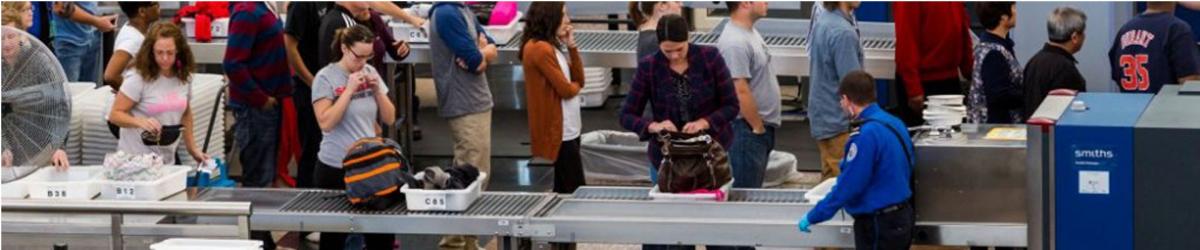
The following items that are banned for carriage on person/hand baggage on board flights operating from civil airports in India; and Indian Registered aircrafts from foreign airports :
 Personal Items
 Sharp Objects
 Sporting Goods
 Guns and Firearms
 Tools
Tools
 Martial Arts / Self Defense Items
 Explosive Materials
 Flammable items
 Disabling Chemicals and other Dangerous Items
Note : The above mentioned are only indicative lists of items. Commonsense, however, shall prevail in assessing whether an object can be used as a weapon for committing any act of unlawful interference with civil aviation operations.
Security related information
Lost and found Baggage

| VEBS AD 2.1 AERODROME LOCATION INDICATOR AND NAME |
| VEBS - BHUBANESHWAR/ DOMESTIC |
VEBS |
AD 2.2 |
AERODROME GEOGRAPHICAL AND ADMINISTRATIVE DATA |
| 1 | ARP coordinates and site at AD | 201448N 0854907E 342.30°/668M From physical extremity of RWY 32 |
| 2 | Direction and Distance from City | BRG 224°/3KM from Bhubaneshwar Railway station. |
| 3 | Elevation/Reference temperature | 138 FT / 39.0°C |
| 4 | MAG VAR/Annual change | 1.10°W (1985) /0.000E |
| 5 | AD Administration, address, telephone, telefax, telex, AFS | Airport Director Airports Authority of India, Biju Patnaik Airport, Bhubaneshwar -751020. Tel +91-674 - 2596300 Tel +91-9437496302 Fax: +91-674 - 2596302 AFS: VEBSYHYX |
| 6 | Types of traffic permitted | IFR/VFR |
| 7 | Remarks | Nil |
VEBS |
AD 2.3 |
OPERATIONAL HOURS |
| 1 | AD Administration | MON-FRI : 0400-1200 UTC (0930-1730) IST SAT,SUN+ HOL : Nil |
| 2 | Customs and immigration | Nil |
| 3 | Health and sanitation | Nil |
| 4 | AIS briefing office | As ATS |
| 5 | ATS reporting office (ARO) | As ATS |
| 6 | MET briefing office | As ATS |
| 7 | ATS | Consult NOTAM for Current ATS HR. |
| 8 | Fueling | Daily : 0200-1700 UTC (0730-2230)IST |
| 9 | Handling | As ATS |
| 10 | Security | As ATS |
| 11 | De-icing | NIL |
| 12 | Remarks | Outside of NOTAM/ATS hours, services are available O/R with 24 HR PN. |
VEBS |
AD 2.4 |
HANDLING SERVICES AND FACILITIES |
| 1 | Cargo-handling facilities | Nil |
| 2 | Fuel/Oil types | Jet A1, AVGAS, 100LL/ Oil MJO II |
| 3 | Fuelling facilities/capacity | Reliance: 5 Refuellers:16000 L (2) , 11000 L (2) , Preset : 700 -750 LPM, 6000L Preset : 400 LPM HPCL : 2 Refuellers : 12000L(1), 15000L(1) Preset : 1200 LPM |
| 4 | De-icing facilities | Nil |
| 5 | Hangar space for visiting aircraft | Nil |
| 6 | Repair facilities for visiting aircraft | Nil |
| 7 | Remarks | Nil |
VEBS |
AD 2.5 |
PASSENGER FACILITIES |
| 1 | Hotels | In the city. |
| 2 | Restaurants | At AD and in the city |
| 3 | Transportation | Buses,Taxi and Car Hire from AD. |
| 4 | Medical facilities | First aid at AD. Hospital in the city. |
| 5 | Bank and Post Office | Banks: In the city. SBI ATM at AD. Post office: within AD ADMN HR. |
| 6 | Tourist office | At AD |
| 7 | Remarks | Nil |
VEBS |
AD 2.6 |
RESCUE AND FIRE FIGHTING SERVICES |
| 1 | AD category for fire fighting | With in ATS HR: CAT - 6 |
| 2 | Rescue equipment | 2 Ambulances |
| 3 | Capability for removal of disabled aircraft | Nil |
| 4 | Remarks | Nil |
VEBS |
AD 2.7 |
SEASONAL AVAILABILITY- CLEARING |
| 1 | Types of Clearing Equipment | Nil |
| 2 | Clearance priorities | Nil |
| 3 | Remarks | Nil |
VEBS |
AD 2.8 |
APRONS, TAXIWAYS AND CHECK LOCATIONS DATA |
| 1. | Apron surface and strength | New Apron | Old Apron | |||
| Surface | Cement Concrete | Concrete | ||||
| Strength | 62/R/B/W/T | 27/R/C/W/T | ||||
| 2. | Taxiway width, surface and strength | TWY A | TWY B | TWY C | TWY D | |
| Width | 23M | 45M | 23M | 10.5M | ||
| Surface | Bitumen | Concrete | Concrete | Bitumen | ||
| Strength | 27/R/C/W/T | 62/R/B/W/T | 62/R/B/W/T | 8/F/C/W/T | ||
| 3. | ACL and elevation | Location | At Apron 201452.2N 0854905.7E | |||
| Elevation | 44M/144FT | |||||
| 4. | VOR/INS checkpoints | VOR | --- | |||
| INS | --- | |||||
| 5. | Remarks:-New Apron Area 54255 Square meters & Shoulder : 7.5M All Around, Taxiway C Length 229M & Shoulder-7.5M.Twy D, Length 166M capable upto Type B Aircraft. New combined apron is located north east of Rwy 14 beginning . (Ramp Equipment Area: 153.5X10M provided on East Side of the Apron. Stand 1 to 6 are Power in Power out.) PARKING STAND CO-ORDINATE CRITICAL AIRCRAFT PCN 1 201506.80N 0854857.70E B767-400 74/R/C/W/T 2 201509.20N 0854855.80E B767-400 74/R/C/W/T 3 201511.70N 0854853.90E A321 74/R/C/W/T 4 201512.80N 0854853.00E A321 74/R/C/W/T 5 201513.80N 0854852.20E A321 74/R/C/W/T 6 201514.90N 0854851.30E A321 74/R/C/W/T | |||||
VEBS |
AD 2.9 |
SURFACE MOVEMENT GUIDANCE AND CONTROL SYSTEM AND MARKINGS |
| 1 | Use of aircraft stand ID signs, TWY guide lines and visual docking/parking guidance system of aircraft stands | Taxiing guidance provided on RTF Taxi -In and Out markings available. |
| 2 | RWY and TWY markings and LGT | RWY: Marked : Designation, THR, TDZ,Centreline, Edge Lighted : THR,Edge,End TWY: Marked : Centerline, Edge Lighted: Edge(TWY A,TWY B & TWY C) |
| 3 | Stop bars | Nil |
| 4 | Remarks | Apron Edge Marking, Aicraft Stand Marking |
VEBS |
AD 2.10 |
AERODROME OBSTACLES |
| In approach / TKOF areas | |||||
| 1 | 2 | 3 | 4 | 5 | 6 |
| RWY NR/Area affected | Obstacle type | Coordinates | Elevation | Marking/LGT | Remarks |
| In circling area and at AD | KHANDAGIRI TEMPLE | 201525.0 N 0854655.0 E | 340 FT | LGTD | NIL |
| APCH-32 TKOF-14 affected | TREE | 201415.0 N 0854928.0 E | 147 FT | NIL | NIL |
VEBS |
AD 2.11 |
METEOROLOGICAL INFORMATION PROVIDED |
| 1 | Associated MET Office | Bhubneshwer |
| 2 | Hours of service MET Office outside hours | H24 --- |
| 3 | Office responsible for TAF preparation period of validity | Bhubneshwer 9 HR |
| 4 | Trend forecast interval of issuance | Trend 30 MIN |
| 5 | Briefing/consultation provided | Provided |
| 6 | Flight documentation Language(s) used | Tabular Form (English) |
| 7 | Charts and other information available for briefing and consultation | S,U85,U70,U50,U30,U20,MFI,WRF,Products Satellite Pictures. |
| 8 | Supplementary equipment available for providing information | Telex, Telefax, Satellite display work Station,DMDD,64 KBPS(VPN) |
| 9 | ATS units provided with information | Bhubneshwer ATC and ACS |
| 10 | Additional information (limitation of service, etc.) | TS Warning,Aerodrome Warning. |
VEBS |
AD 2.12 |
PHYSICAL CHARACTERISTICS |
| Designations RWY NR | TRUE & MAG BRG | Dimensions of RWY (M) | Strength (PCN) and surface of RWY and SWY | THR coordinates | THR elevation and highest elevation of TDZ of precision APP RWY (FT) |
| 1 | 2 | 3 | 4 | 5 | 6 |
| 14 | 143.37° GEO 144.50° MAG | 2743 x 45 | 56/F/B/W/T. Bitumen | 201538.80N 0854816.80E | THR:104.0FT TDZ:124.0FT |
| 32 | 323.37° GEO 324.50° MAG | 2743 x 45 | 56/ F/B/W/T. Bitumen | 201427.70N 0854914.10E | THR:122.0FT TDZ:130.0FT |
| 05 | 50.87° GEO 52.00° MAG | 1379 x 45 | 18 R/C/W/T. Bitumen | 201427.20N 0854847.00E | |
| 23 | 230.87° GEO 232.00° MAG | 1379 x 45 | 18 R/C/W/T. Bitumen | 201453.50N 0854920.90E |
| Slope of RWY-SWY | SWY dimensions (M) | CWY dimensions (M) | Strip dimensions (M) | OFZ | Remarks |
| 7 | 8 | 9 | 10 | 11 | 12 |
| +0.11% | 60 x 45 | --- | 2863 x 150 | --- | --- |
| +0.11% | 60 x 45 | --- | 2863 x 150 | --- | --- |
| +0.63% | 60 x 45 | --- | 1499 x 150 | --- | Operation on RWY 05/23 restricted to light aircraft only. |
| +0.63% | 60 x 45 | --- | 1499 x 150 | --- | Operation on RWY 05/23 restricted to light aircraft only. |
VEBS |
AD 2.13 |
DECLARED DISTANCES |
| RWY designator | TORA (M) | TODA (M) | ASDA (M) | LDA (M) | Remarks |
| 1 | 2 | 3 | 4 | 5 | 6 |
| 14 | 2743 | 2743 | 2803 | 2743 | 1 : 50 |
| 32 | 2743 | 2743 | 2803 | 2743 | 1 : 50 |
| 05 | |||||
| 23 |
VEBS |
AD 2.14 |
APPROACH AND RUNWAY LIGHTING |
| Designations RWY | APCH LGT TYPE LEN INTST | THR LGT COLOUR WBAR | VASIS (MEHT) PAPI | TDZ, LGT LEN | RWY centre line LGT Length, spacing, colour and intensity | RWY edge LGT Length, spacing, colour and intensity |
| 1 | 2 | 3 | 4 | 5 | 6 | 7 |
| 14 | CAT-I 778M HIGH | Green | PAPI Left/3° 15.103M | NIL | NIL | 2743M 60M white |
| 32 | SALS 240M HIGH | Green | PAPI Left/3° 10M | NIL | NIL | 2743M 60M white |
| RWY end LGT colour WBAR | SWY LGT LEN (M) colors | Remarks |
| 8 | 9 | 10 |
| Red | NIL | --- |
| Red | NIL | --- |
VEBS |
AD 2.15 |
OTHER LIGHTING, SECONDARY POWER SUPPLY |
| 1 | ABN/IBN Location, characteristics and hours of operation | ABN : At Tower Building, FLG W&G EV2SEC. As ATS HR IBN : NIL |
| 2 | LDI location and LGT Anemometer location and LGT | LDI: Avbl Anemometer: On tower building not lighted |
| 3 | TWY edge and centre line lighting | Center line: Nil Edge: TWY A,B,C :TWY D- Nil |
| 4 | Secondary power supply/switch-over time | Secondary Power supply to all lighting. Switch-over time : within 15 Sec. |
| 5 | Remarks | Apron Flood Lights Available |
VEBS |
AD 2.16 |
HELICOPTER LANDING AREA |
| Not Established |
| VEBS | AD 2.17 | ATS AIRSPACE |
| 1 | Designation and lateral limits | Bhubneshwer CTR :A circle radius 30NM Centered at 201437.2N 0854847.7E BBS (DVOR). |
| 2 | Vertical limits | GND to FL50 |
| 3 | Airspace classification | D |
| 4 | ATS unit call sign Language(s) | Bhubneshwer Tower English |
| 5 | Transition altitude | 4000 FT AMSL |
| 6 | Remarks | Caution for local (powered and glider) training flights in the AD circuit. |
VEBS |
AD 2.18 |
ATS COMMUNICATION FACILITIES |
| Service designation | Call sign | Frequency | Hours of operation | Remarks |
| 1 | 2 | 3 | 4 | 5 |
| APP | Bhubneshwer Tower | 125.15 MHZ | AS ATS | --- |
| TWR | Bhubneshwer Tower | 125.15 MHZ | As ATS | --- |
| ATIS | Bhubaneshwar Information | 126.8 MHZ | As ATS | --- |
VEBS |
AD 2.19 |
RADIO NAVIGATION AND LANDING AIDS |
| Type of aid CAT of ILS/MLS (For VOR/ILS/MLS, give VAR) | ID | Frequency | Hours of operation | Site of transmitting antenna | ELEV of DME transmitting antenna | Remarks |
| 1 | 2 | 3 | 4 | 5 | 6 | 7 |
| NDB | BS | 302.0 kHz | H24 | 201530.0 N 0854859.0 E | --- | --- |
| LLZ 14 | IBHR | 109.1 MHz | As ATS | 201422.2 N 0854917.7 E | --- | CH336X |
| GP 14 | - | 331.4 MHz | As ATS | 201534.2 N 0854827.3 E | --- | |
| DME (DVOR) | BBS | 1106/1169 MHz | H24 | 201437.2N 0854847.7E | 122FT | Collocated with DVOR |
| DME( ILS) | IBHR | 989/1052MHz | As ATS | 201534.2N 0854827.3E | 45FT | --- |
| DVOR | BBS | 113.5 MHz | H24 | 201437.2N 0854847.7E | --- | --- |
VEBS |
AD 2.20 |
LOCAL TRAFFIC REGULATIONS |
| ----------------------- |
| VEBS | AD 2.21 | NOISE ABATEMENT PROCEDURES |
| ----------------------- |
| VEBS | AD 2.22 | FLIGHT PROCEDURES |
| ----------------------- |
| VEBS | AD 2.23 | ADDITIONAL INFORMATION |
| Additional Wind sock commissioned at a distance of 200M and Brg 300 Deg from ARP. Windsock lighted during night. LLZ Tx-2 clearance restriction upto 32 DEG lifted.GP restricted for use upto 150 ft. |
| VEBS | AD 2.24 | CHARTS RELATED TO AN AERODROME |
| 1. | ILS RWY 14 | |
| 2. | VORRWY 14 procedure chart split into VOR (Z) RWY 14 and VOR(Y) RWY 14 | |
| 3. | VOR RWY 32 procedure chart split into VOR (Z) RWY32 and VOR (Y) RWY 32 | |
| 4. | NDB RWY 32 |


Airports Authority of India,
Rajiv Gandhi Bhawan,
Safdarjung Airport,
New Delhi-110003
Ph : 91-11-24632950


